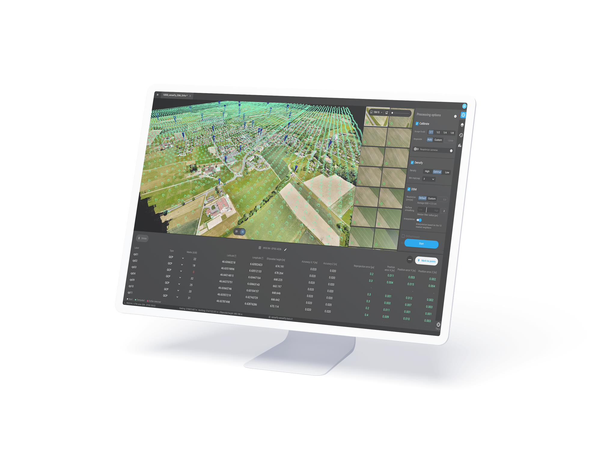
Pix4Dfields; photogrammetry software designed for precision agriculture and crop analysis; converting drone images into orthomosaics; digital surface models; index maps; zones; and prescription maps.
It supports selected multispectral sensors like Parrot Sequoia cameras or MicaSense RedEdge cameras; as well as standard RGB and modified RGB cameras.
The software is known for its ease of use; speed; and ability to process images offline; making it a valuable tool for farmers and agricultural researchers.
Create and use prescription maps directly with your machinery – no third party software needed
The ultimate agricultural toolkit
In-field or In-office
Rapidly create maps without leaving the field (offline available); for faster decision-making and action.
Fast & accurate insights
Get maps of your fields and crops at any stage using satellite and/or drone imagery.
Unique tools
From images to insights; create crop health maps; field reports; spot spraying; and prescription maps for your agricultural machinery.
Easy sharing
Share your data via PIX4Dcloud as PDF reports and in industry standard formats.
Check if your drone is supported here
Inspect; analyze and visualize your crop changes all year round
Fast processing – Accurate processing
Process imagery with the PIX4Dfields instant processing engine and achieve results in minutes in-office and in-field. No internet required.
Generate indices
Use the predefined list of agricultural indices or input your own custom index formula to understand your plant stress better.
Zonate and prescribe
Aggregate the information from the vegetation index maps into zones and assign application rates.
Measure and Annotate
Add annotations and measure important farm areas.
Magic tool
AI-assisted selection tool to quickly detect and select weed nests; damage; and other anomalies in orthomosaic and index layers
Targeted Operations/Prescription maps
Create highly customizable variable rate and spot spraying prescription maps for spray drones; tractors; and field sprayers.
John Deere Operations Center
Upload aerial maps; Crop health maps; Field boundaries; and Prescription maps directly from PIX4Dfields to your Operation Center
Create and analyze real time maps of your crops to enhance your agriculture workflow
Easily scout your farm and generate the appropriate output for your needs
Orthomosaic Vegetation index map Zonation map Annotations Digital surface model (DSM) Spot Spraying – Prescription maps
See all outputs