
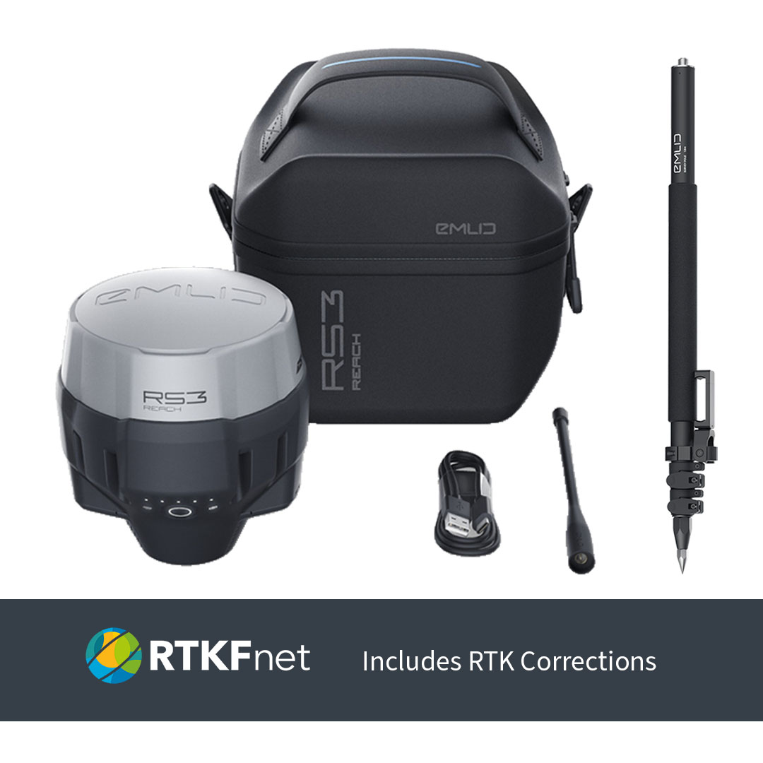
Emlid’s Reach RS3 is an RTK GNSS receiver with IMU tilt compensation and a UHF radio; designed for precise positioning in challenging environments. It supports multi-band GNSS signals; including GPS; GLONASS; BeiDou; and Galileo; and can achieve centimeter-level accuracy within about 5 seconds.
The IMU-based tilt compensation allows for accurate measurements even when the receiver is tilted up to 60 degrees; and it is immune to magnetic interference; making it suitable for use near metal structures or electronic devices.
Emlid’s Reach RS3 is waterproof up to one meter depth and can operate in harsh conditions; with an industrial battery that can last up to 22 hours of logging or 18 hours of working in RTK mode. It can connect up to 10 rovers via the internet or through an NTRIP network; and it supports RINEX logging for post-processing with software like Emlid Studio.
At Innovelec; we are committed to delivering exceptional service to users of Emlid’s Reach RS3. Our support is tailored to meet the unique needs of each customer. Please feel free to contact us to discuss how we can best assist you.
Emlid Reach RS3 Industries
The RS3; a full-featured; survey-grade GNSS receiver with IMU-based tilt compensation; LoRa and UHF radios; and multi-band RTK/PPK support is ideal for:
Land Surveying
Boundary and topographic surveys
Stakeout in uneven or obstructed terrain (thanks to tilt compensation)
Use with local base stations or CORS networks
Construction
As-built verification
Stakeout and layout in tight or obstructed areas
Integration with BIM workflows
Mining & Aggregates
Grade staking and volumetric measurements
Use in areas with poor cellular coverage via LoRa/UHF
Drone Mapping
Acts as a base station for RTK drones
Collects ground control points (GCPs) with tilt compensation
Public Safety & Forensics
Rapid deployment for crash scene or disaster mapping
Accurate results even with large tilt angles
The IMU-based tilt compensation in Reach RS3 enables you to make measurements with up to 60 degrees of tilt while still staying within 20 mm of accuracy.
Reach RS3 continuously measures and corrects tilt in real-time to keep you on target.
Survey and stakeout faster
No need to check the bubble
0 Seconds
8 Seconds
15 Seconds
Effortless and robust
IMU tilt compensation
Calibration-free
We calibrate the inertial measurement unit in each device individually at the factory; so you can get your GNSS unit up and running right out of the box.
Immune to magnetic disturbances
Unaffected by magnetic fields; RS3’s GNSS and IMU sensors provide robust tilt compensation even when working close to metal structures.
Related products
Business & Industrial > Construction > Surveying
Business & Industrial > Construction > Surveying
Business & Industrial > Construction > Surveying
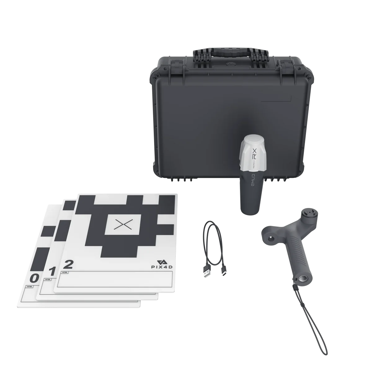
PIX4Dcatch Precise 3D scans and AR (Subscription Plans: Professional, Length: 3 Years)
Business & Industrial > Construction > Surveying
PIX4Dcatch Precise 3D scans and AR (Subscription Plans: Professional, Length: 1 Year)
Business & Industrial > Construction > Surveying
Business & Industrial > Construction > Surveying
Business & Industrial > Construction > Surveying
Emlid RCH205 Reach RS3 Professional RTK Survey Kit – Emlid Reach RS3 with NTRIP & Accessories