Unlock the full potential of your surveying and mapping projects with the PIX4D / Emlid scanning kit.
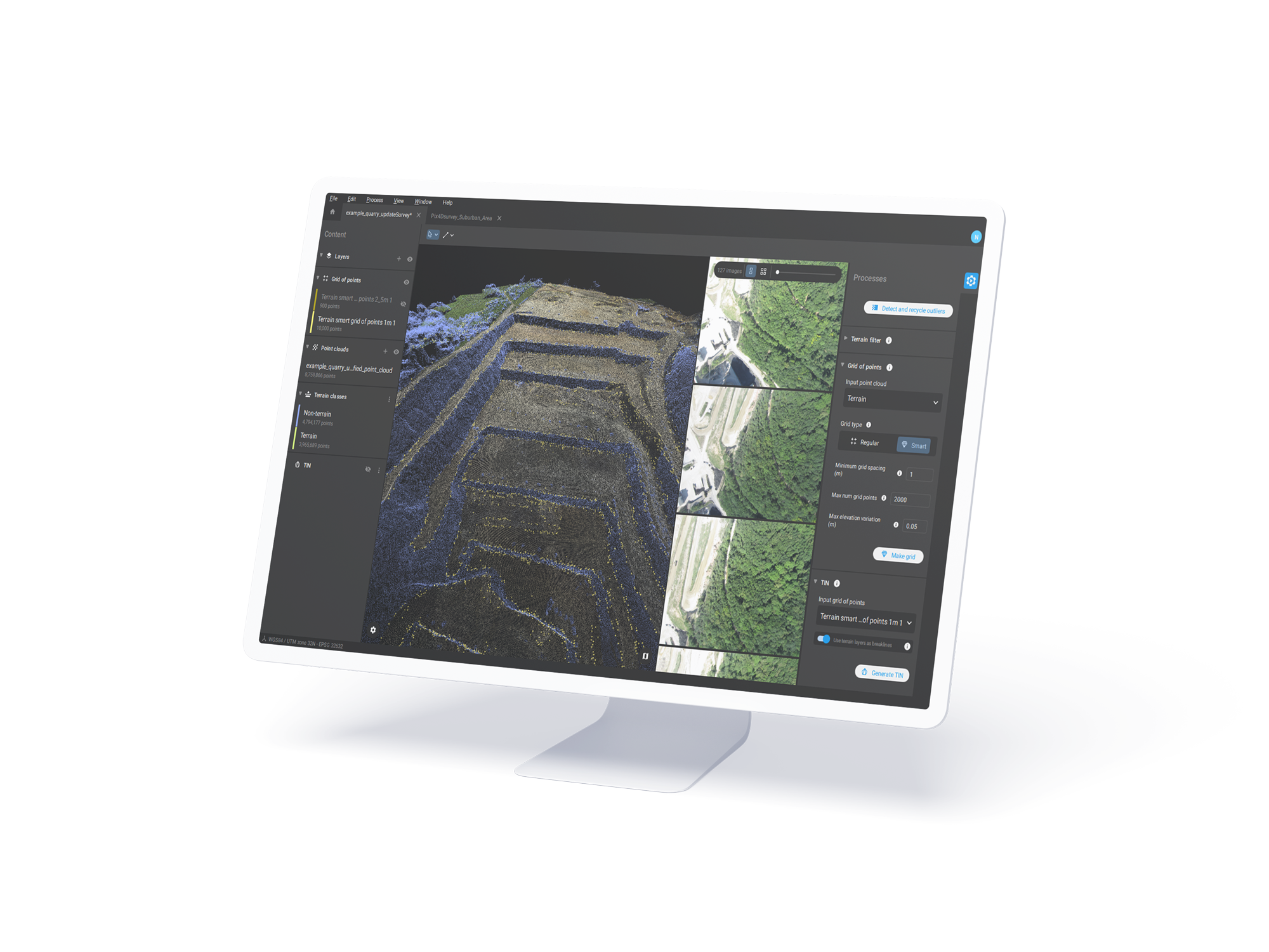
A complete solution designed for accuracy and efficiency. By integrating PIX4D’s industry-leading photogrammetry software with Emlid’s high-precision GNSS receivers; and enhancing it all with real-time RTK corrections; this kit delivers centimeter-level accuracy from data capture to final output.
Whether you’re working in construction; agriculture; or land surveying; you can trust this seamless system to streamline your workflow; reduce the need for ground control points; and provide reliable; professional results every time.
Emlid Pix4d Standard Scanning Kit
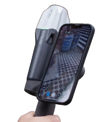
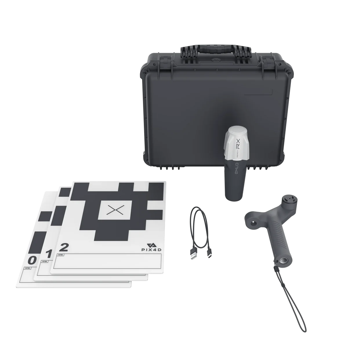
The Emlid Pix4D all-in-one kit is purpose-built for professional 3D scanning; offering everything you need to get started. The package includes a 1-year subscription to PIX4Dcatch Professional and PIX4Dcloud; along with the Emlid Reach RX RTK antenna and ergonomic handle. To ensure a smooth onboarding experience; the kit also comes with an online course; making it easy to master PIX4D’s powerful tools right from the start.
Emlid Pix4d Advanced Scanning Kit
The advanced 3D scanning kit is designed for professionals seeking both flexibility and precision; offering seamless online and offline processing capabilities. This comprehensive package includes one-year licenses for PIX4Dcatch Professional; PIX4Dcloud Advanced; PIX4Dmatic; and PIX4Dsurvey; along with the Emlid Reach RX RTK antenna and ergonomic handle. To help you get started quickly and confidently; the kit also comes with access to an exclusive online PIX4D training course.
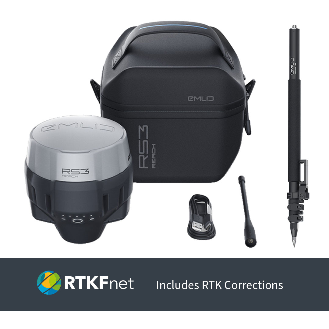
RTK Corrections
We’re proud to partner with RTKFnet in the UK; enabling us to offer reliable RTK corrections that enhance the performance of the Emlid PIX4D 3D Scanning Kit. This collaboration ensures our customers benefit from precise; real-time positioning for all their surveying and mapping needs.
If you would like to discuss your renewal; please contact us. Alternatively you can renew by visiting the links below.